Drone 3D scanning gets pitched like a futuristic extra, but for the right site it is simply a practical way to get better information faster. Regina contractors, developers, facilities teams, and property managers often need more than nice aerial photos. They need a usable record of what exists on site, how structures relate to each other, and where planning problems are going to show up before crews, quotes, or tenants get dragged into avoidable confusion.
That is where aerial scanning starts to make sense. Instead of treating the drone as a marketing toy, you use it to build a clearer site model, document conditions, and support decisions that are hard to make from scattered ground photos alone. If you are specifically comparing options for mapping, measurements, or progress documentation, the dedicated drone 3D scan page is the most direct place to start. The broader drone lane covers the wider aerial workflow around it.
First, know what 3D scanning is actually buying you
The value is not “because it is 3D.” The value is that it can create a more complete visual and spatial record of a site than a simple photo set. That matters when multiple people need to review the same property, when measurements influence the next quote, or when the site is large enough that memory and phone snapshots stop being reliable.
For Regina property teams, that often means fewer arguments about site conditions and better coordination between the owner, manager, consultant, and contractor. For contractors, it can mean getting a cleaner pre-job reference before mobilizing labour or material. For some jobs, that alone saves enough time to justify the work.
It is worth it when the site is large, awkward, or expensive to revisit
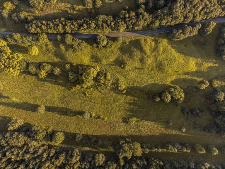
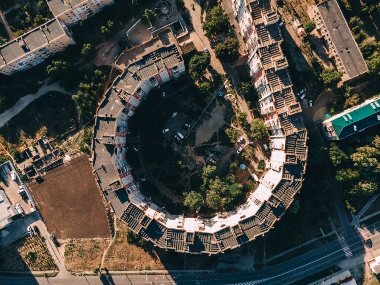
Not every property needs a scan. A small straightforward repair usually does not. But once a site gets large, irregular, or hard to inspect efficiently, the math changes. Multi-building sites, exterior renovation zones, roof-heavy properties, commercial lots, and spaces with access constraints all benefit more from a full existing-conditions record than from a few hero images.
It also becomes more valuable when a second site visit is expensive. If the project team is juggling estimators, trades, ownership review, and approvals, a reusable aerial model helps more people evaluate the same reality without constant re-attendance. That is a real savings in time, not just a tech flex.
Contractors usually feel the value during planning and quoting
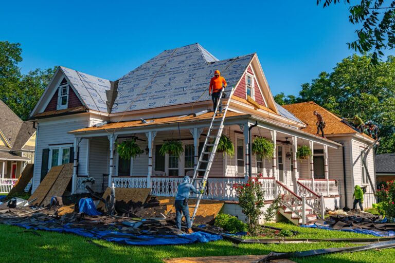
Contractors in Regina are often forced to price work with incomplete visual information. Ground photos miss context. Handwritten notes get messy. The estimator remembers one thing, the crew lead sees another, and then the site walk happens again because nobody trusts the first pass enough to move cleanly.
A drone scan can help when you need to review roof sections, exterior access, surrounding grade, lot layout, staging constraints, or the relationship between one structure and the next. It is especially useful when the question is not only “what does this look like” but also “how do we plan around it.” If your team already benefits from aerial inspection work, related documentation like a roof inspection workflow can also support the decision-making chain.
Property teams benefit when documentation needs to survive turnover
Property managers and facilities teams deal with a different kind of problem: continuity. The person who knows the site best is not always the person sending the next contractor, approving the repair, or explaining the issue six months later. A clean scan-backed record helps preserve site knowledge in a way casual smartphone documentation usually does not.
This matters for capital planning, maintenance review, exterior condition tracking, and tenant-facing properties where disruption should be minimized. If a team needs a better basis for comparing bids or explaining why a scope changed, better documentation improves the conversation before anyone starts pointing fingers.
It is also worth it when progress tracking needs to be defensible
Some projects do not need a one-time scan. They need repeatable documentation across phases. If a build, renovation, or site-improvement project needs periodic visual records, aerial scanning can help create a more consistent baseline than random jobsite photography. That is helpful for owners, contractors, and consultants who need to show what changed, what was complete at a given stage, and where issues started showing up.
Regina weather makes this more useful than people think. Prairie sites shift fast with wind, mud, thaw, snow, and seasonal wear. When timing matters, a documented record is often more valuable than verbal certainty.
When it is probably not worth paying for
It is not a fit for every assignment, and saying that out loud is part of using it well. If the site is tiny, the scope is simple, and the decision can be made from ordinary photos or a direct walkthrough, a scan may be unnecessary. If nobody on the project actually needs a model or broader documentation set, you may just be creating files that sit untouched.
The test is simple: will the scan reduce uncertainty, reduce repeat visits, improve planning, or strengthen documentation in a way the team will actually use? If the answer is no, basic aerial coverage or even a standard ground review may be the better call.
Prep the site so the scan can do its job
Like every other drone service, the output depends on site readiness. If the property is cluttered, blocked, or full of temporary obstacles that do not reflect the real working condition, the model becomes less useful. Clean prep does not mean sterile staging. It means making sure the scan captures the truth you actually want people making decisions from.
Before scanning, it helps to:
- confirm the real purpose of the deliverable with the contractor or property team
- identify any zones that must be captured in higher detail
- move vehicles, bins, or loose materials if they are obscuring the working area
- flag access, safety, or tenant-notice issues ahead of time
- decide who needs the final files and how they will be used
That kind of planning keeps the flight focused and makes the deliverable more useful after the drone lands. If the job also includes listing visuals or broader site media, the related real estate drone prep post can help frame what makes aerial coverage read clearly.
Think in decisions, not gadgets
The best reason to use drone 3D scanning is not that it sounds advanced. It is that it helps the people on the job make cleaner decisions with less guesswork. For Regina contractors, that can mean better estimates, better sequencing, and fewer wasted return visits. For property teams, it can mean better records, clearer communication, and more confidence when scopes or conditions get reviewed later.
If that sounds like the actual problem you are trying to solve, a scan is probably worth discussing. Start with the 3D scan service page, explore the wider drone workflow, or reach out through contact Robert with the site type and what decision the images need to support. That usually makes it obvious pretty quickly whether a drone scan is overkill or exactly the right tool.
Related reading from Sinfull Studios
- Commercial Drone Photography for Events in Regina: What to Expect and How to Book
- Drone Cinematography in Regina: Aerial Filming That Serves the Story
- Drone Roof Inspection vs. Traditional Inspection: What Regina Homeowners Need to Know
- Drone and Aerial Imaging in Regina
Based in Regina, Saskatchewan. Explore Drone and Aerial Imaging or request a quote from Sinfull Studios.