Saskatchewan doesn’t look like the van life content you see online. No ocean backdrop, no redrock canyons, no perfect golden-hour mountains. What it has is something harder to photograph but better to drive: space. Real, unbroken, almost aggressive space. Here are the routes worth your time and an honest account of what living this in a 1976 Chevy G20 is actually like.
Routes Worth Driving
Qu’Appelle Valley
The Qu’Appelle cuts east-west through the southern prairies — a river valley that shouldn’t exist by the logic of the surrounding flatness. The valley walls drop 60–80 metres off the plains, and at the bottom you get lakes, campsites, and actual trees. The drive along Highway 56 through the valley is one of the more dramatic road experiences in the province precisely because the contrast is so abrupt. Fort Qu’Appelle is a good supply stop. Steele Narrows Provincial Park at the eastern end has solid camping with water access.
Grasslands National Park
The West Block of Grasslands is the most remote park experience in Saskatchewan and arguably the most honest version of what this land looked like before everything changed. Mixed-grass prairie, coulees, bison herds, black-footed ferrets, and a genuinely dark sky at night. The road into the West Block is gravel most of the way — passable in most vehicles in dry conditions, a different conversation in wet. There’s no cell coverage for significant stretches. Plan for that. Val Marie is the last fuel and supplies stop before you go in.
Cypress Hills Interprovincial Park
Technically straddles Saskatchewan and Alberta. The elevation here — the Hills sit higher than the surrounding plains — means forest cover, cooler temperatures, and a microclimate that feels genuinely different from everything around it. Good for summer heat escapes. The Saskatchewan side (Centre Block) is less developed than the Alberta side, which means fewer facilities and more quiet. The road through the hills from Maple Creek is excellent pavement with actual curves — a rarity.
Hudson Bay Area and the Eastern Fringe
Highway weekends around Hudson Bay (the town, not the body of water) and into the Porcupine Hills to the north deliver boreal forest, lakes, and a population density that makes you feel like you’ve left the province entirely. The Greenwater Lake Provincial Park loop is worth the drive. Cell coverage drops in and out; download your maps offline before you leave the last town.
Northern Lakes Circuit
Prince Albert National Park anchors the north end of what most people consider accessible Saskatchewan. Waskesiu has supplies and fuel. Beyond that — Narrow Hills, Candle Lake, Tobin Lake — you’re on your own more than you might expect. The fishing is legitimate. The roads are a mix of decent two-lane provincial highway and gravel that varies enormously by season and recent maintenance. Check with local gas stations about current road conditions; they’ll tell you things Google won’t.
Road Realities: Gravel, Coverage, and Wildfire Season
Saskatchewan has more road length than most provinces and a fraction of the population to maintain it. That means gravel. Lots of it. Some gravel roads are graded and smooth; others are washboarded badly enough to shake loose anything not bolted down. Learn to read the surface from a distance — a fresh-graded road looks different from a neglected one. Drive slower than you think you need to on gravel. Stone chips are the leading cause of windshield replacements out here.
Cell coverage: expect none north of a certain latitude unless you’re near a town. SaskTel has the best rural coverage in the province but it’s still not everywhere. A satellite communicator (Garmin inReach or equivalent) is worth the subscription if you’re going off the main routes.
Wildfire season typically runs May through August and can close provincial parks and access roads with short notice. Check the Saskatchewan government’s wildfire map before heading north, especially in dry years.
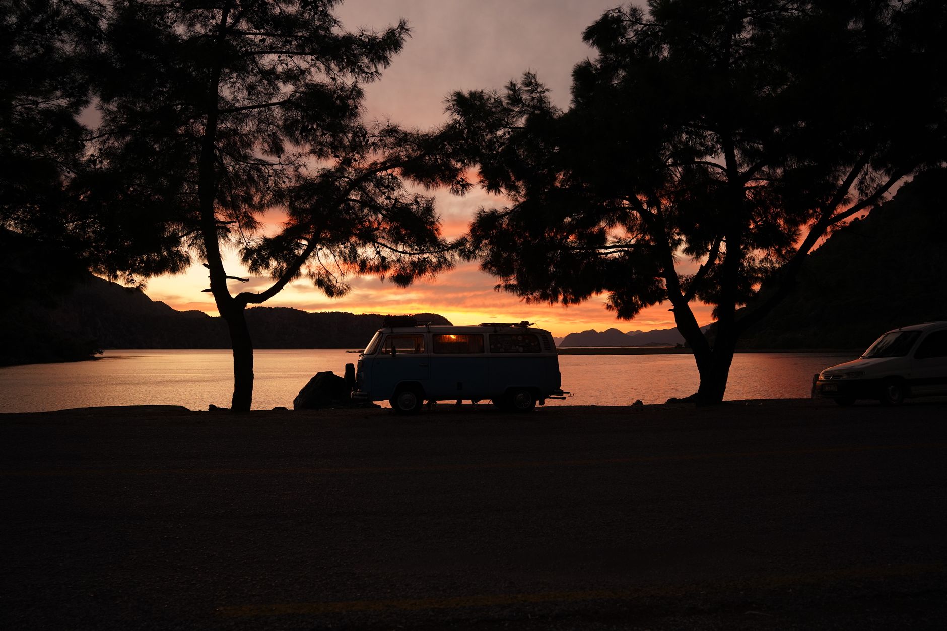
The G20: Why an Old Van Beats a New One
The 1976 Chevy G20 is not a practical van by any modern metric. It drinks fuel, it has no electronic anything, and it requires the kind of mechanical attention that new vehicles have engineered away. That’s also why it works for this kind of travel.
Simplicity means field-repairable. A carburettor problem doesn’t need a scan tool — it needs someone who knows carburettors. Out on the prairies, that person might be a farmer with a shop. On a modern van with a CAN bus fault requiring dealer diagnostics, you’re waiting for a tow. The G20 can be broken down and fixed by someone competent with basic tools. That’s not nostalgia; it’s risk management.
The other thing nobody says: old full-size vans are tall enough inside to stand up, wide enough to sleep crossways, and built with enough metal to feel solid in the wind that comes off the plains sideways at 80 km/h. Modern van conversions are often beautiful and almost always compromises.
What Prairie Van Life Is Actually Like
It’s not Instagram. The light is extraordinary in specific windows — magic hour before a thunderstorm, the half hour after sunset when the sky goes every colour at once — and ordinary for the rest of the day. The distances between things are real. You will drive 200 km on a highway with nothing but canola and sky and you will be fine, or you will hate it. There’s no middle ground.
What makes it worth it is the version of quiet you can’t find anywhere with more people. Camping in Grasslands on a Tuesday in September with no cell signal and the only sound being wind and occasional distant bison: that’s something specific. You can’t replicate it.
More van life routes and on-the-road writing lives in the van life archive. The G20 and the prairies aren’t done yet.
Related reading from Sinfull Studios
- Prairie Van Life Expectations vs Reality: What Actually Breaks First
- Powering a Van Build: Solar, Batteries, and a Realistic Electrical System Cost
- Winterizing a 1976 Chevy G20 for Saskatchewan: What Actually Matters
- Van Life in Regina
Based in Regina, Saskatchewan. Explore Van Life or request a quote from Sinfull Studios.